Nuclear Free Future Run - 2004
Day 2, To Prestonburg, Ky
|
|
PeaceHq |
|
|
Nuclear Free Future Run - 2004 |
|
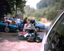
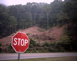
Monday, August 2nd, 2004 Highway 23 followed the Big Sandy River from where it met the mighty Ohio, and was the boundry between Kentucky and West Virginia for many miles into the foothills of the Appalachian mountains. Our starting point for the day was close to where the Big Sandy split into the Tug Fork (which remained the border between the states), and the Levisa Fork, which followed highway 23 past Prestonsburg, and Pikeville on up toward Elkhorn City where it became the Russel Fork in Breaks Interstate Park on the Virginia border. We would camp near Prestonsburg tonite, and take highway 80 southwest toward Hazard tommorrow. The route was a new 4 lane with the kind of wide shoulders the run/walkers love to travel, because the safety factor made focusing on footprayers much easier than the narrower roads. As it winds its way into the eastern Kentucky coalfields through heavily wooded ridges and valleys, the elevations begin to climb into respectable mountain ranges. Being monday instead Sunday, the first thing I noticed when I started the first of my 2 - 4 mile sections was the semi - coal trucks by the hundreds roaring up and down the hughway at 70 or 80 miles per hour. They added a new dimension to the noise and road dust, and the full ones would fling out minute particles that would actually sting when they hit you. A little distracting perhaps, but we managed to complete our footprayers. Going southwest into the mountains, we knew we were going to encounter steeper hills along our route. Although the forested mountains generated a special feeling within those who love Mother Earth, we knew those steep uphill sections were going to take some of the starch out of our collars and spring from our steps. It is generally accepted that he who gets the biggest hills to climb is the luck of the days schedule, and this day the luck was with (or against, depending on how you look at it) Jim Toren. Just outside Prestonsburg there is the highest elevation highway pass in this part of the mountains of eastern Ky. It is a formidable hill called by the locals "water gap". We don't know why they call it Water gap, but it is one of many hills throughout this part of the country which has those signs about trucks using lower gears going down the hills. In actuality they have to stay in those lower gears on the upslope as well, and some of the fully loaded coal trucks barely make it over the gap. I had spent some time working in this area so I was familiar with "water gap" and wondered who had the dubious honor of going over it during their miles. Later in camp I asked Jim about his adventure and he related as how he barely made it over the high "water gap". He earned our respect and the award for the toughest section of road for the day. Unless you have pounded the pavements a little, it is hard to imagine how rubbery your legs can get on a major uphill section. Sometimes all you can do is lower your head, plod on, and hope you make it over the top. Because of the heat of the day and the hills we all had faced in our sections of highway, we were glad to enter the Jenny Wiley State Park to make camp for the night. It is a picturesque campground overlooking Dewey Lake. After setting up camp and showers, it was decided to go into Prestonsburg for supper. We wandered around for awhile, but finally found a genuine Mexican restaurant with surprisingly good food. We enjoyed at least an hour and a half of free air conditioning along with plenty of delecious, spicy food, and all the cold drinks we could consume. Comfortable and sated, we returned to the campsite, but this wasn't to be the end of our day quite yet. Jim brought out the peace cranes, and the group all tried their hand at origamically folding the little birdies. 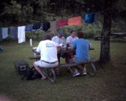 Jim had pledged to hang 1000 peace cranes on the fence at the Y 12 Plant and we were still quite a few short. We ended up gathered around the picnic table, folding peace cranes, and swapping tales of other days on the road til late into the evening. At some point I had to become horizontal or risk falling down, so to bed I went.
TIL THE AM! |
Participants Jim Toren John Toren Jon Blickenstaff Jon Burkindine Larry Crane Mark Porter-Webb Terry Stagman Day 1 Day 3 Home |